Samuel Cote Preserve
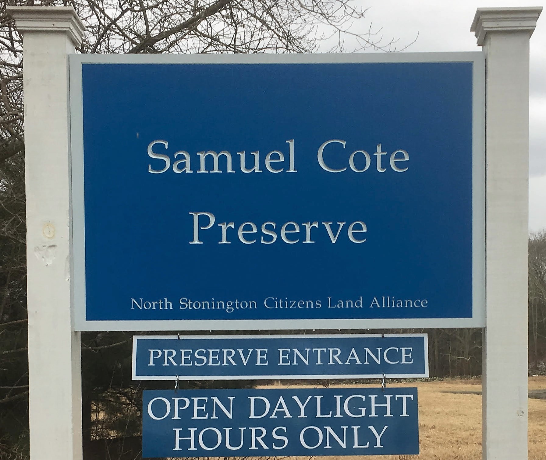
SAMUEL COTE PRESERVE
(31 Acres)
We opened on Sunday, September 24, 2017 at 1:00 PM for the first time.
Several people came on a beautiful sunny day with beautiful blue sky to walk these
unusual and serene 31 acres of
hay and corn fields, pine forests with paths of pine
needles underfoot, 500 feet along Spalding Pond.
The Preserve is open Daylight Hours Only . Look for Preserve sign at 32c Clarks Falls Road,
near Pendleton Hill Road/Clarks Falls junction.
Dogs on leashes okay.
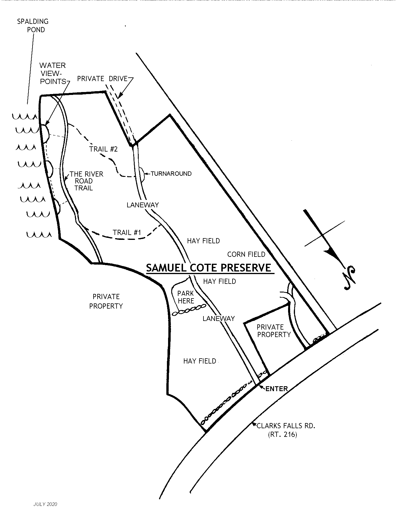
Comfortable walking, no hills, no rocky climbs. See trail map and photos below.
The geodetic map shows that this preserve is part
of a flood plain of fertile soils.
The autumn leaves don’t last long so try to get to the Samuel Cote Preserve soon to see the gorgeous colors reflected in Spalding Pond. Note that Spalding Pond is now part of the National Wild and Scenic Rivers System. https://www.rivers.gov/.
From their website: Rivers in the National Wild and Scenic Rivers System capture the essence of all waterways that surge, ramble, gush, wander and weave through our country. From the remote rivers of Alaska, Idaho, and Oregon to the rivers threading through the rural countryside of New Hampshire, Ohio, and Massachusetts, each preserves a part of American story and heritage.
Check out how our little pond fits into this nationwide system.

Yellow leaves Spalding Pond October 2024

Spalding Pond October 2024

National Wild and Scenic River
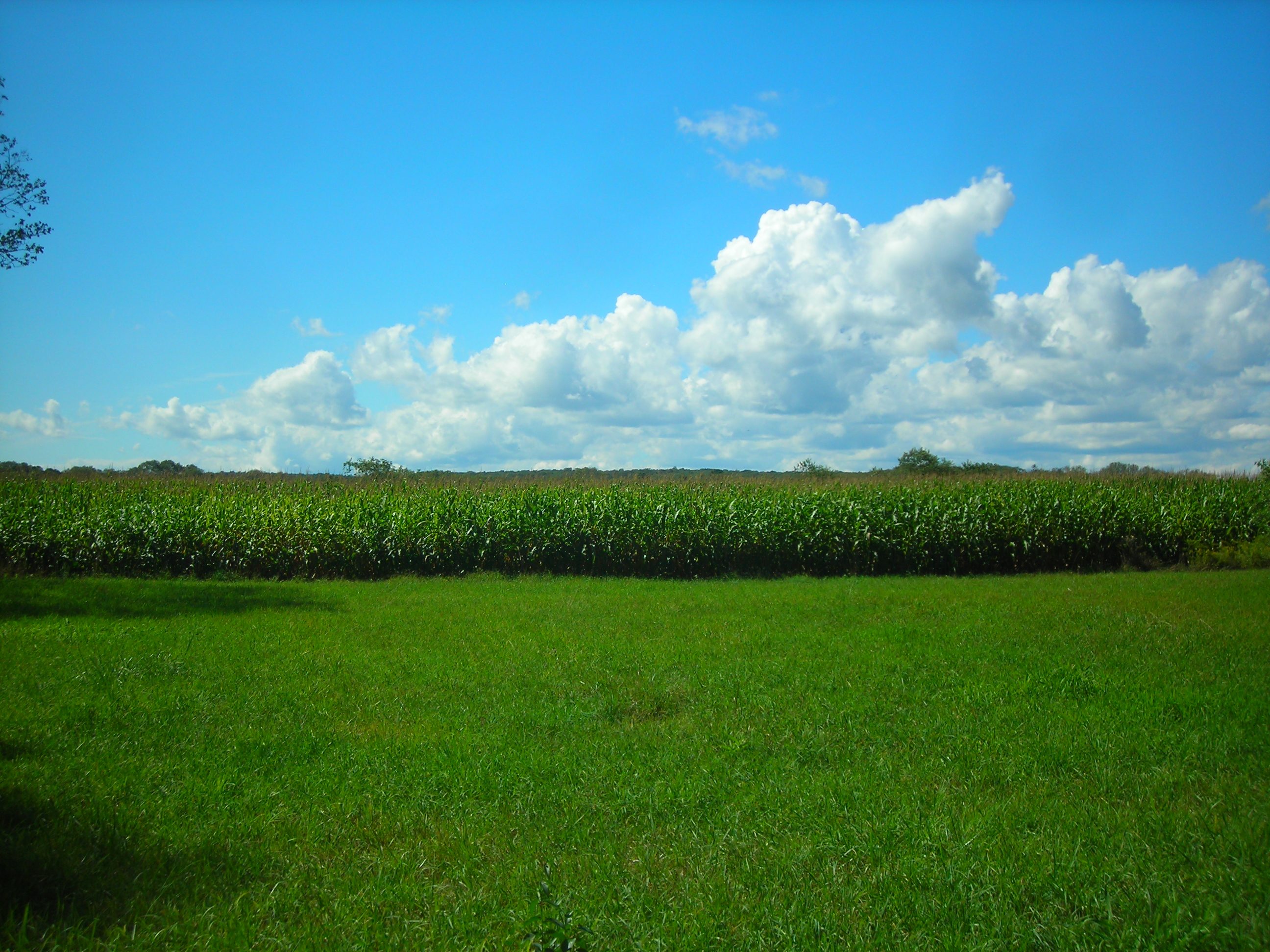
HAY AND CORN FIELDS AT SAMUEL COTE PRESERVE
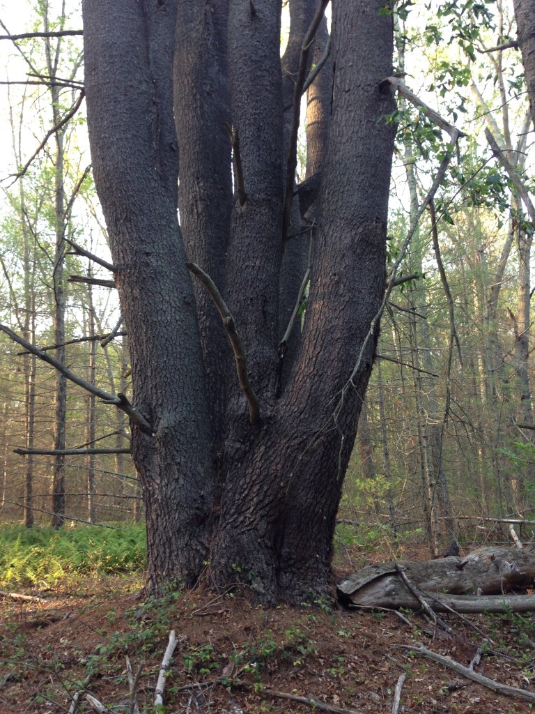
HUGE WHITE PINE AT SAMUEL COTE PRESERVE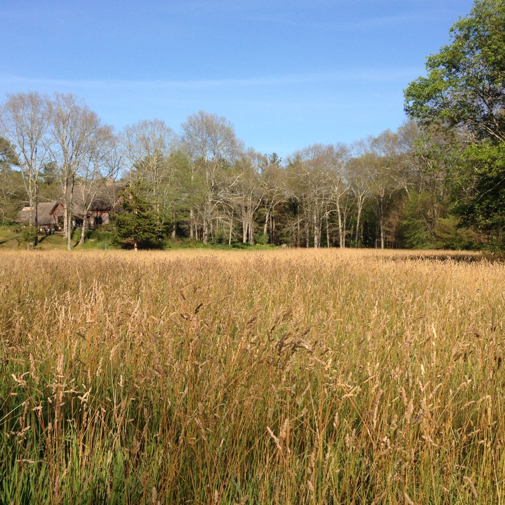
Yellow leaves Spalding Pond October 2024Yellow leaves Spalding Pond October 2024 HAYFIELD AT SAMUEL COTE PRESERVE
For the Town’s Map, either click the link below:
https://mapxpress.s3.us-east-1.amazonaws.com/northstonington/parcelmaps/QM_104-8260.pdf
OR: Scan the code below with your smart phone for link to the Town’s Map

Samuel Cote Preserve_Town Quick Map
OR: Right-click and copy-paste the trail map below for printing. There should be maps at the trailhead in the mailbox.
Click on the following link to access URI’s Watershed Watch Data and scroll down to Spaulding Pond for the latest information on water quality there.
Watershed Watch Data-Spaulding Pond
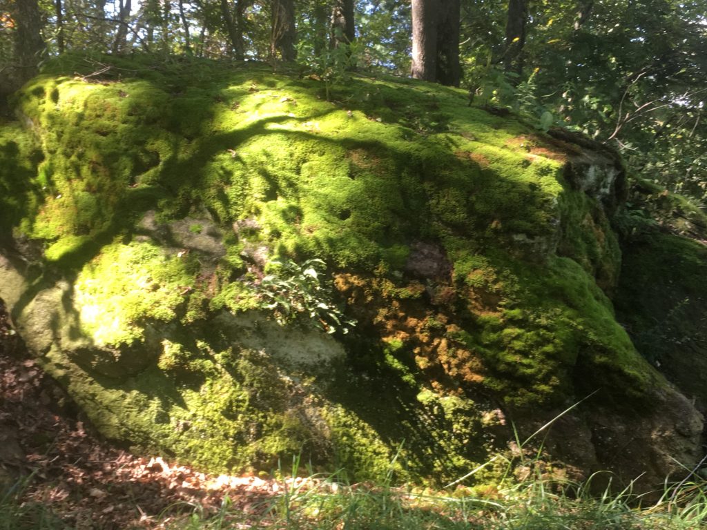
MOSS ROCK ALONG LANEWAY – SAMUEL COTE PRESERVE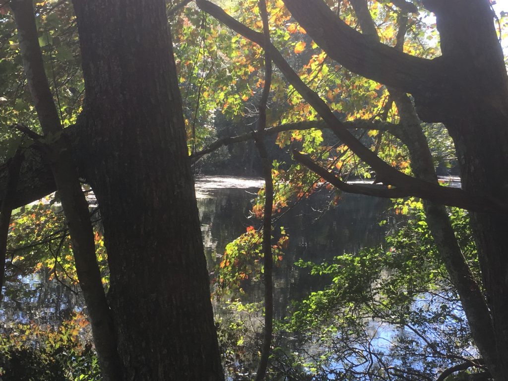
SPALDING POND – VIEW ALONG THE RIVER ROAD TRAIL
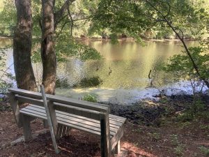
RESTFUL SPOT ON THE SAMUEL COTE PRESERVE
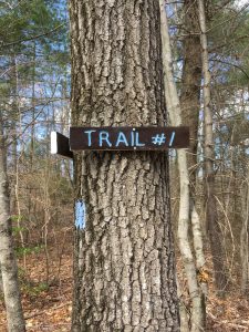 Sign at Trail #1 along the Laneway
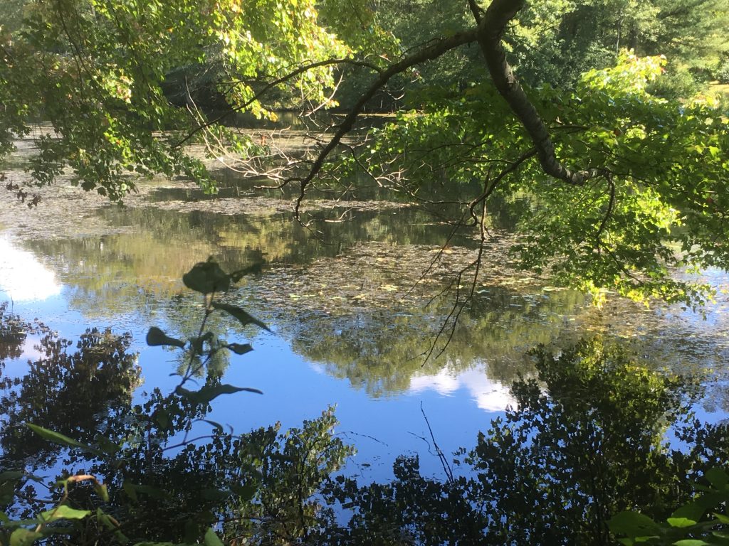
SPALDING POND VIEW – SAMUEL COTE PRESERVE